Monday, 28 March 2016

Coastal Grasslands near the Tip of Australia

Behind the mangroves of the great inlets of Western Cape York Peninsula are vast grasslands that can be a few kilometres wide and many kilometres long.  This post shows a grassland at Port Musgrave and some images of Unigan nature reserve in Weipa.

View across grassland toward paperbark woodlands on far side
Looking toward bauxite plateau over a sward of salt tolerant sedges (click to enlarge)
These grasslands, which are also known as marine plains, form an extended transition between sea and land.  Marine plains have an imperceptible slope, descending at 1 m per kilometre from landward edge to mangrove edge.  Within the plain, the vegetation gradually changes from seasonal freshwater wetland to saline marine flats.

Tea tree sapling in blady grass on a marine plain, Port Musgrave
View of wet blady grass flats near bauxite plateau with mangroves in distance
The grasslands are both spectacular and a challenge to the senses.  Their great uniformity offers no secrets and it is tempting to leave after a few minutes.  Yet this is a unique and productive ecosystem and if you can adjust your perception, there are things to be seen and environmental lessons to be learned.  People used to live in these areas, how did they survive?

The dangers of these areas that needs to be considered before setting out to experience them.  Savage feral cattle which were set free in this area over a century ago and without much parasite resistance, are crankier than modern cattle.  Feral pigs seek out the best patches of wetland and turn them into hectares of muddy slosh.  After walking through these areas I needed treatment for hook worms, which created thin itchy trails of blood beneath my skin.  The well-known threats of crocodiles and snakes are probably less of an issue here than elsewhere as they are not easily found even when searched for.  In the dry season fire is a serious risk.  When all of Cape York Peninsula is on fire, the air becomes thick with smoke and distant views are lost.  Fire is often out there but you don’t know exactly far away it is, so it pays to have firm ideas of how to escape in the event.  I have not seen a grassland burn, but I imagine it makes its own winds and would be a fierce unpredictable hazard.  Most grasslands are burnt annually.  Finally during the wet season, grass swamps can be heat traps where the air is still and humidity reaches 100%.  In the worst conditions, human endurance is about ten minutes.  Even dark still waters can become so hot that they are above the threshold of pain.  Warning over, lets continue.

Feral short horn bull, Port Musgrave
These things are more of a health hazard than crocs
Surrounding the inlet is a thin band of mangroves.  A single high tide every 24 hours (not two as is normal) would not provide enough flushing to keep dry season salinity down.  The neap tide-spring tide cycle would leave many areas to dry out for weeks on end.  It is very saline close to the inlet. The inner edge of the 100 m wide mangrove fringe has a strange thicket of club mangroves with swollen stems and salt encrusted leaves.  In a few places tall succulent shrubs are present, which resemble cactus with fine branches.

Mangrove fringe, Port Musgrave
Mangrove fringe around inlet showing zonation of species with increasing salinity.
Inner edge of mangrove fringe has a thicket of club mangroves (Aegialitis annulata

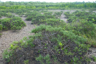
Chenopod shrubland on marine plain, Port Musgrave
Small areas have unusual shrublands with 1 m high succulents (Tecticornia indica)
A narrow saltpan separates the mangroves from the grasslands.  Soils in this area are swelling-cracking clays.  These black clay soils which are normally found in inland areas swell greatly when wet and conversely shrink and crack deeply when dry.  Few tree species can endure this type of ground movement.  Well below the the low ridge that marks the limit for regular spring tides, there is a strange grassland which must flood with seawater many times each year.
Xerochloa imberbis grassland, Port Musgrave
Xerochloa grassland fringed with Batis.  Mangroves in distance
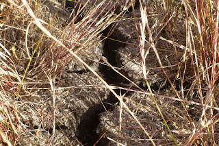
Cracking soil of a marine plain on Cape York Peninsula
Large cracks let the soil dry out
Closeup of green Xerochloa imberbis stems
Xerochloa imberbis has tiny leaves and mainly uses stems for photosynthesis
Landward of the king tide ridge lies a broad sedge flat.  The heaving of the soil probably creates small round Gilgai wetlands in which Chinese water chestnuts (Eleocharis dulcis) grow.  Pigs seek dig up many of these wetlands and may have even created a simple agricultural system, where they deepen and improve the swamps that grow their food.  Humans can eat the tubers as well and they taste great, raw or cooked.
Chinese water chestnut in natural habitat
A large spring-fed drainage line with Eleocharis reeds and stunted mangroves.  
Despite heavy rains, drainage lines in the grassland are tiny or non-existent across most of the grassland.  Rain would have to drain across flat ground through decomposing vegetation and even dense beds of aquatic plants that spread below the grass.  Before the water could drain, more rain would have fallen keeping the area wet for months on end.  In the dry season, the flatness and impervious clay soil ensure that once the surface moisture is gone, drought will commence suddenly and be unrelenting.  This is an ecosystem that switches between being waterlogged and drought stricken.

In bauxite areas, freshwater seeps out of springs and into the grasslands from the base of the jump-up that separates marine plain from bushland.  Until the beginning of June, these areas have lush grasslands, with grass taller than a man.  Then in August/October, these areas burn.  The total loss of vegetation is hard for small wildlife to cope with and the area has many pigs and dingoes, both of which are major predators so there is very little wildlife even frogs.  Poor nutrient status of the soils probably also contributes to the scarcity as even cattle do not thrive here.

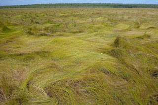
Panicum trachyrhachis grassland
Panicum trachyrachis wet grassland
Wet grassland, Cape York Peninsula
Floating Azolla fern, bladderworts and other species form an aquatic understorey 
Burned grass stems on marine plain
Stems of grassland burned before completely dry (~August)
In Unigan Nature Reserve, which is near Weipa, signs of the original aboriginal people who lived grassland-mangrove boundary remain.  They ate cockles in vast quantities and discarded the shells form huge heaps which rise above the grasslands like artificial islands.  Native fruit trees provide shade.  How they fished for cockles in the crocodile capital of Australia and how they survived nights with mosquitos that drill into bone, I think those secrets are lost.

Close up of cockle shells
Cockles were on the menu
Heritage-listed cockle shell mound near Weipa
One of the heritage-listed shell mounds that is in the middle of a grassland and close to the mangroves


Tuesday, 15 March 2016

Largest Landslide in Australia

The Captain Cook Highway, which runs from Cairns to Port Douglas is an iconic coastal road, yet it has a violent geological past that has too soon been forgotten.  Torrents of stone and mud have periodically transformed the landscape with the most recent event permanently burying parts of the original highway.  In some places where the current highway veers away from the beach, it is actually crossing over debris fields deposited in part by an immense recent landslide.  The primary historical record for this event appears to be a small Cairns Post article from Monday 15 January 1951 which reported:
“It will cost the Main Roads Commission many thousands of
pounds to repair a six-mile stretch of the Cook Highway between
Buchan and Simpson's Points, following huge landslides caused
by a torrential downpour lasting nearly five hours.
Almost unbelievable quantities of earth and debris were swept
from the mountain-side down on to the roadway and over the
precipice into the sea. Gigantic trees were uprooted and ground to
pulp, and boulders as high as 10 feet hurled into the Pacific- as if
they were marbles.
Millions of gallons of water cascaded down the mountains into
the sea, gouging huge ravines and making swiftly running streams
in the thousands of tons of earth and rubble left on the road in the
wake of the slides.”
Why are there no detailed records of the most violent landslide in Australian recorded history? Despite being in living memory and cutting the highway to Port Douglas for a few weeks, finding a photograph of this event or even a map of where it occurred seems to be impossible.  I have been trying to piece together what happened for a few years now and the story just gets bigger.

Near Cairns there are a number of places which are prone to these massive events, which could be up to 1000 times larger than the tragic Thredbo landslide.  These events could cause serious loss of life and property and there needs to be less complacence about this issue.

Approximately 2 km north of Ellis Beach are a few pretty sandy beaches with boulder headlands at each end.  A further 1.5 km north there is a boulder beach that is 3.5 km long.  The origin of the boulders on this mostly ignored stretch of coast is the subject of this post.  The native bedrock of this coastline is a slate-like metamorphic stone whereas the boulders are granite so it is clear that the boulders came from somewhere else.  These boulders provide a means of tracing the debris flows back to their origins.

Coastline with round granite boulders
A boulder beach near Ellis Beach in Far North Queensland (Click to enlarge)
For a moment lets stay at the boulder beach.  Relative to surrounding coastlines, it is a biological desert.  There are no oysters, barnacles, macro-algae and very few limpets and grazing gastropods.  I saw some trails in the sand from nerita snails, which is odd as they normally live on rocks. Perhaps the grazing snails which should be present in countless millions are being knocked off the smooth stones by waves.  Even under the rocks, there is hardly any life.  The round shape of the rocks means that even a large stone provides almost no shelter below.  I do not think that the rocks roll around in normal rough weather, this coast is a sheltered coast and the stones are very large being from 50-80 cm.  The slope of the beach is also very low and would gradually dissipate wave energy.  In contrast, at a nearby steeply sloping, south-east facing beach with 20 cm cobbles, it is possible to hear and feel vibration from rocks being tumbled around in the 1.5 m beach break.  On the boulder beach, I think that polishing by sand and lack of shelter from the elements makes this environment so hostile to marine life.  Large boulders that stand further out to sea have the expected level of life.  On the boulder beach, the only notable lifeforms were the strange black rings of blue-green bacteria, which are a stone-like encrustation.  The rocky shore of Island Point which was covered in a recent post makes an interesting comparison.
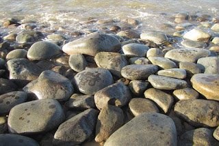
Almost lifeless boulder beach
Sand polished boulders near low tide level
In Google Earth, you can see that there are many small creeks flowing down the coastal escarpment and each appears to have delivered stone to the coast.  Between the creeks are hard metamorphic hills which constrain the positions of the creeks and hence direct the flow of stone.  All of the boulder headlands have formed in the mouths of creeks.  Between the creeks are very steep hill faces that press against the beach.  These slopes may look like an obvious source of stone but inspection reveals that these metamorphic hills make very little contribution.

Aerial view of Simpsons Point
Landslide debris creates headlands on Captain Cook Highway
Simpsons Point from the side, showing boulders pushed into the sea by a debris flow
In the aerial photo near the highway are patches of dark green forest.  These forests grow on debris fans that have spread out and settled before hitting the sea.  Pockets of dry rainforest find protection from fire in rock-rich debris fans.  Close to the top of the aerial image, is a potential source of stone as the bedrock switches to granite part way up the 700 m tall coastal escarpment.  Small areas of bare rock slab can be seen.  Granite begins 250-350 m above sea level and approximately 750 m from the sea when measured horizontally.  That is a long way for thousands of tonnes of stone to move.  Some of the largest boulders that can be seen from the highway are nearly 8 m in diameter.  Evidence for how the stone moved so far is best found by following the small creeks up toward their origins.

While most debris fans have dry rainforest, the debris fan in the catchment explored in this post had a glade of cycads that was more than 100 metres across.  Cycads are at their best in rocky ground.

Cycad understorey in eucalypt woodsland
The glade of cycads
Climbing up toward the top of the debris fan, the rock content of the soil became more obvious.  Between the rocks are seasonal herbs such as hibiscus (H. meraukensis) and Polynesian arrowroot (Tacca leontopetaloides).  At the edge of the debris fan, the vegetation of the glade suddenly gives way to the vegetation of metamorphic hills; ironbark and kangaroo grass woodland.

Herbs that spring up from bulbs during the wet seasons fill spaces between the cycads
Ironbark woodland
Ironbark woodlands cover metamorphic hills beside the old debris flows
Beneath the woodland vegetation is a thin skeletal soil over solid metamorphic stone.  On some of the steeper slopes, the rock is so close to the surface that grass cannot grow, though trees can exploit cracks between the vertically tilted layers to obtain what they need.  With time and weathering metamorphic reluctantly breaks down into flakes of rock and then clay without producing boulders.  Only when competent metamorphic bedrock is exposed by rivers and streams does this rock form boulders.  Initially the boulders are blocky but with time the edges are worn away.  Yet the boulders nearly always retain flat surfaces in contrast to granite which forms round stones.

A naturally bare patch showing metamorphic rock fracturing and flaking
Solid metamorphic rock lies below the surface
Above the debris fans, the creeks follow deep gullies incised into metamorphic bedrock.  Debris flows are not as nimble as water and rather than flowing down the watercourse, they tend to fill it up like a glacier.  A creek which was 5 m wide may be filled with a stream of stone and earth over 50 m wide.  At the centre of the debris flow, the deposited material may be 4-6 m deep.  Stream waters have to find a new way down the gully and usually form new channels on either side of the debris flow.  Between these channels, the consolidated debris flow becomes a raised strip of bolder strewn forest which develops its own distinct vegetation.  When stream waters erode the edges of the debris flow, they create vertical faces that allow the depth and make-up of the debris flows to be examined.

Cardwell lilies
Cardwell lilies fill the understorey on the new forest in the gully
Unaltered material from the stalled debris flow
Red earth and stone between the tree roots show the original character of the debris flow
Fresh landslide debris would contain as much earth as stone, but over time the earth washes away, leaving only the stones.  Trees which have grown on the landslide debris end up with roots looping trough the air as the ground settles and washes away.  Interestingly the remnant debris flow contains a red earth that appears to be of metamorphic origin, and not decomposed granite or sandy clay which is associated with granite boulders that form in situ.  This mix of geologies suggests a mechanism for these massive landslides.

A contact zone slip plane with a layer of weathered metamorphic rock resting on top
The mountains beside the Cook Highway formed when magma rose up into cracks that formed in the deep deposit of ocean sediments at a time when the east coast was under tension.  The sediments were cooked into metamorphic rocks and the magma solidified to form granite.  All granite forms at least two kilometres below the surface and is then uplifted, however usually the stone into which the granite intruded has long eroded away leaving only the granite geology.  Along most of the Cook Highway, the granite is still in the process of losing its cover of metamorphic rock.  Between the metamorphic rock and the granite is a contact zone which is a hard, almost mirror smooth surface probably composed of melted marine sediment.  These surfaces are steeply sloping and are hundreds of metres long.  There is no more perfect slip plane.  At the top of the mountain is exposed granite, which weathers in the usual fashion and creates boulders.  They mystery is how hundreds of thousands of tonnes of earth and boulders suddenly become mobile and I don't really know so I am going to speculate about what I think happens.  The slope is approximately one in three, which from my carefully conducted experiments of rolling rocks down slopes, is the steepest slope where rolling rocks are more likely to come to rest than keep rolling.  Usually they come to rest after after hitting an obstacle or a few inefficient end over end tumbles.  Many boulders created by weathering of granite outcrop might roll down until the collide with trees or terrain and collect on the mid-slopes of the range which have metamorphic soils.  Soil and small stones washed down from the kilometre long slopes above the exposed rock faces may also build up over time on the rock faces, creating landslide fuel for the future.
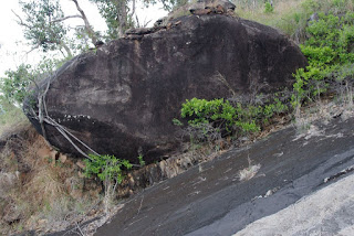
Giant boulder resting on steep slope
A big rock that almost kept rolling
red earth on a steep slip plane
A wedge of soil on a slip plane. The slope in the foreground probably shed its load.
In deducing the mechanism for these landslides, It would really help to know where the landslide originated, above the mid-slope granite exposures or below?  Unfortunately, it does not appear that this information was recorded for the 1951 debris flow.  Geosciences Australia  (GA) in their report titled Quantitative Landslide Risk Assessment of Cairns (AGSO RECORD 1999/36) estimates that the landslides described in this post brought down between 180 000 and 720 000 tonnes of material and buried sections of highway to a depth of 3 m.  GA consider that the rainfall event that triggered this landslide has a return interval of about 400 years, however that does not factor in climate change.  The key issue may also be accumulation of material over a slip plane rather than rainfall and the rate of this process was not  estimated in the report.  I would think that the return interval for large landslides could be in the order of 100-200 years.

When the ground does let go, the one thing that is certain is that the debris flow hurtles down the gullies.  Beside the small creek I followed, the debris flow averaged 30 m wide and formed an elevated inclined plain.  It is likely that nearly all the trees present in the gully would have been ripped from the ground and carried away.   Occasionally, when a few large trees formed a row across the gully, they were able stand against the debris flow.  These trees by virtue of their being there to halt part of the debris flow provide indirect evidence that the flow occurred decades ago, not hundreds of years ago.  In many places the sides of the gully were scoured back to bedrock.  The evidence shown here is repeated in most of the creeks on this section of coastline.  On some of the larger and most damaged creeks, the vegetation has not recovered.  When the trees were destroyed, tall exotic grasses and lantana moved in to form a blanket of weeds that have suppressed the regeneration of forest.
The sloping surface of the old debris flow occupies the middle of the gully
A few trees stood against the onslaught and built a wall of rocks
Burdekin plum tree (Pleiogynum timoriense) on debris field.
The tree on the right has roots at two levels showing that it has seen 2 debris flows.

Sunday, 6 March 2016

Glass Eels are Arriving in our Creeks

On 6 March 2016, it was a dark still night (~8 pm) and the tide had just peaked when I took a look in a tiny creek at the northern end of Palm Cove, Cairns, Queensland Australia.  The small fish that leap when a torch is shone on the water where not to be seen today and I had to look for creatures.  After a few minutes, it became apparent that every few seconds a tiny, clear living thread would zoom past. They were hard to catch and it took a while to get the first one.

Anguilla reinhardtii elver or glass eel

Anguilla reinhardtii
Glass eel or elvers of longfin eel (Anguilla reinhardtii) - click to enlarge
Most of them were following the thin film of freshwater that lay at the surface of the tidal creek. They were mostly moving through the thin film of the very margins of the creek, where the creek cut across the sandy beach.  In all the photos that follow, the gravel that is visible is actually some of the finest whitest sand in Cairns and it is just the small size of the eels that makes the sand look coarse.

Glass eel moving up the very boundary of the water - probably following a salinity gradient
Three glass eels are present in this photo
The glass eels rested momentarily in the mangrove detritus before striking out again.  It proved to be easier to capture the resting eels.  A highly venomous box jellyfish was also bumping its way along the bank.

Chironex fleckerii
Box jellyfish with 2 cm bell
It was so hard to photograph these small creatures in the surging water, I made a video.  The clarity is not great as fresh and saltwater are mixing near surface creating haze.


I captured a few glass eels to photograph and later placed them in an established freshwater fish tank with a few neon tetras.  The elvers seemed to handle an instant transition from saltwater to freshwater well and were alive in the morning.  Instant transitions kill most fish as their gills have to switch from excluding salt to absorbing it and kidneys from excreting salt to recovering it.  I guess that animals which are desperately seeking freshwater can handle sudden transitions.

Glass eels become large freshwater longfin eels when they grow up.  The creek at Palm Cove is very small and it is a wonder that glass eels were attracted to it.  There was a noticeable salinity gradient with relatively fresh water present at the very surface.  Upstream there is only 100 m of mangrove creek before the vegetation transitions into a paperbark/rainforest swamp forest.  These areas tend dry out in the dry season so how do the eels survive?  Back in April 2014, I was looking around in this area for interesting biodiversity when I found a mature eel half out of the water in the mangrove roots. I thought the eel was dead but when I got close, it took off.  Perhaps the eel was surviving by taking refuge in a thin film of freshwater floating above the seawater.

Mature longfin eel using mangrove roots to lift its body to/above the surface.
Place where I found the eel

Postscript
I took a few eels and let them go in my fish tank.  Two weeks later, most seem to be still alive.  After about 4 days they started to develop a dark skin, but their flesh is still clear.  During the day they hide under objects but at night they swim frenetically, perhaps 40 cm per second.  So they are not just trying to reach freshwater, they want to penetrate upstream as fast as possible.


Saturday, 5 March 2016

Beach Recovery at Yorkeys Knob

In the 1950's the sea was threatening to eat the houses on esplanade at Yorkeys Knob.  The original cause of this crisis took place in 1927, when the Barron River had carved a new channel through the cane fields to connect Thomatis Creek which flowed to the Barron with Richters Creek that went to the sea.  This new route was seven kilometres shorter than the old course of the Barron River.  Some years later, the mouth of the Barron also moved north by nearly 2 km after breaking through the beach during a flood.  Rivers pump sand out into the sea, yet only when the near shore waters near river mouths become almost choked with sand, do waves to return some of this sand to the beach.  It has taken nearly eighty years for the flow of sand back to the beach to be restored and beach to grow to its maximum width.

Changes in Yorkeys Knob Beach 1952-2015 (click here to enlarge)
Sand mining from the bed of the Barron River continued until the 1990's and intercepted both the 20 000 tonnes of sand coming down the river each year and consumed an additional 70 000 tonnes per annum of previously deposited bed load.  This consumption of the sand supply had a terrible effect on the beaches particularly Machans Beach and Holloways Beach, which lie between the old mouth of the Barron River and the new mouth at Richters Creek.  The fight to protect Holloways Beach and Machans Beach are covered in previous posts (see Coastal Protection in the subject index).  In contrast, Yorkeys Knob Beach is positioned to receive the high volume of sand that takes the shortcut to the new mouth and as soon as sand mining stopped began to grow quickly.

The growing width of Yorkeys Knob Beach provides more than a happy story of how a beach was saved, it is a chance to answer a swag of questions about how coastal features form as they have literally been forming in front our photographic eyes.  These questions are important to land management as well as being scientifically interesting.  Developers like to claim that dense coastal vegetation is just regrowth and that they should be able to remove some of it to create views.  Dense vegetation developing where previously there was open sea could affect the public by blocking cooling sea breezes and possibly by allowing increased mosquito activity.  Conversely, a wider beach with dense vegetation provides a much better buffer against storms.  Scientifically interesting aspects include the development of landscape features such as chenier ridges form and how and why some areas become impoverished grassland yet metres away a ferny rainforest is created.  Topics of scientific interest will be covered in future posts.

In overview, it appears that between 2002 and 2008, the beach got wider by approximately 5 metres  per year.  From 2008 to 2016, the position of the beach has been stable as sand is now able to escape around the rocks at the northern end of the beach.  Recently the beach has been getting higher rather than wider, with the foredune growing about one metre in height.  As the beach grew, a series of small ridges and swales were created that are now stabilised by dense grass and herb cover.  In places trees colonised, mostly in lines that were probably created by high tides washing seeds up onto the foredune.  Many of these seedlings have grown to become trees that are approaching maturity.  In places the dense wall of regenerating trees is lifting off the ground and an open understorey is developing where is breezy and open but shady.
2010 (left) and similar 2016 views (right).  The foredune has become much higher and has continuous vegetation
Another important observation is the resurgence of native plants.  In my first intensive survey of this area, much of the vegetation on the low dunes was composed of introduced species.  There was para grass, guinea grass, Tridax daisy, Hyptis, Singapore daisy, Chinese violets and Mossman River grass, which has nasty burrs that penetrate our skin.  Most of theses exotics have waned and been replaced by a vigorous sward of native grasses and herbs.  Healthy natural vegetation looks better than weed infested areas.  Native plants seem to fit together, each providing a different visual texture and each occupying a defined area.  In contrast exotic species tend to run rampant and form smothering tangled masses which 'lack natural design'.  The exotics are still present but have only a minor presence.  The photos below show how they were.
Top: Tridax daisy and Mossman River Grass (the nasty one)| Bottom: Singapore daisy and Hyptis
For me, seeing these changes is not a matter of good memory.  Since approximately 2004, I have been photographing a very wide range of subjects using geotagged photos.  I am possibly one of the leading practitioners in the world when it comes to using photos to track ecological change, yet after more than fifteen years of development, I am still working hard to make a system that makes it easy monitor the environment with photos.  If anybody thinks that they can do time series research without having developed or acquired powerful tools for this purpose, they will have a very hard time matching photos in future.  In another post I will describe how to use photos for monitoring.  Most of the hard work is done by a database application that I have been developing for many years.  The information in this post comes mainly from my personal photo collection, aerial imagery from Google Earth (thanks Google) and some really old aerial imagery that I have scanned in.  To make the beach fit better on the page. the aerial photography has been rotated.

Coverage of geotagged photos - you can never have enough