Wednesday, 25 May 2016

River Surfing in Cairns?

Just after writing about how the mouth of Barr Creek can have violent episodes, I was able to actually able to film another creek having one.  Deep Creek at Clifton Beach is about one quarter the size of Barr Creek and longshore often blocks its mouth with sand during the dry season.  Last week the mouth of the creek was a mere trickle and then we had a little bit of rain.


The creek came up so fast that a little old lady who went for a walk along the beach could not get back.  I had helped her wade back across by walking out into the sea and crossing where the force of the water was less.

Some people arrived and were quite worried that their big dogs would jump in and get washed away but dogs have skinny legs and seem to be able to walk through really fast water so they relaxed.  Then everyone just started having fun.  A man was trying to body surf the waves but his dog kept climbing on his back and riding him like a surf board which was really annoying.  .

This time I could stand in right beside the channel and film the biggest of the waves just in front of me and I saw a lot of things that I had never seen before and you can see some of them in the video.  The standing waves move slowly upstream.  When they get really big, they collapse into rolling surge of slosh and which is washed downstream leaving the surface of fast flowing water almost flat.  After a few seconds, a new set of standing waves formed and over twenty seconds grew to full size and then as before collapsed.  I always thought that ocean swells moved through the flood and made the standing waves peak but this is not the case.  The standing waves were in this case a self-generating cycle.  In some of the standing waves, vortices are making patterns in the crests of the waves.

In my search for information about standing waves I discovered that if Barr Creek was in America, people would go nuts about it.  The Waimea River on the Hawaiian Island of Oahu is their version of Barr Creek


Does Barr Creek really compare to the Waimea River?  They are almost perfectly matched - look at this.

Barr Creek with 500 m scale bar (images Google Earth)
Waimea River in Oahu, Hawaii
The difference is that Barr Creek has a maximum drop to the sea of about 3.5 m whereas the Waimea River drops down by 6-7 m as the beach is built up high by 10 m waves (their king tides are only 0.5 m!).  Barr Creeks standing waves top out at about a 1.5 m high whereas the Waimea River standing waves seem to be twice as big at full power.  Like the Waimea River, one has to wait until the mouth is blocked and the creek fills up with freshwater and when it is on the point of bursting out.  Kids sometimes dig a channel on a very low tide and off it goes.  Unfortunately this is not a common event.  However Barr Creek has several tide powered events every year and where the water drops about a metre between the creek and the sea and there is still plenty of action.  These  events are bigger than my video of Deep Creek.  The best time to play is when the creek is running fresh during the wet season and you do not have to worry about box jelly fish but you always have to look for crocodiles.


Saturday, 21 May 2016

How the Creek Ate the Beach

Strange combinations of normal events can synergise to do as much damage to the coast as cyclones.  As climate change kicks in and slight increases in sea level and slight intensifications of trade wind systems occur, these synergies become more significant as these events are likely to cause somewhat more damage and take somewhat longer for nature to repair.  In fact in recent years, most of the damage to the Queensland coastline in places that were not directly hit by cyclones, seems to be due to synergistic events.

A nice wide beach is just what you want on coming into the cyclone season
About 8 weeks later the beach was entirely gone leaving nearby houses highly exposed (23 Dec 2011)
Coming into the cyclone season, I was happy that the southern end of Holloways Beach had a 25 m wide crest that would provide an effective buffer against most cyclones.  A few weeks later this buffer had been entirely eaten away completely and trees were being undermined and some were falling into the sea.  The culprit was a combination of high tides and strong winds which is a regular and not very destructive occurrence, synergising with the meandering of the small tidal creek to create the most efficient beach erosion system I have ever seen. 

The eroding sand cliff was over 2 m high in most places 
In about 60 days, the mouth of Barr Creek moved by approximately 300 m and many thousands of tonnes of sand was removed from the beach.  In previous post I have covered how Barr Creek which is tiny tidal creek can become a serious geomorphological force when high tides combine with longshore drift.  In this post, I will describe how this same system became locked into a highly destructive cycle that resulted in the creek mouth rapidly migrating northward along the beach and eating away the protective foredune in the process.

Same position, looking in the opposite direction with the creek mouth in its normal state
Where Barr Creek crosses the beach, it meanders just like any other creek that flows through sandy ground.  Straight sections of creek begin to curve and curves grow more pronounced until they cut through the crest of the beach and new mouth forms.  Usually the meandering curves are restricted to the protected estuary side of the beach with the creek straightening just in time to pour into the sea.  Low swells and high chop often surge into the creek mouth on the incoming tide and dissipate their energy in the shallow waters over the sandbanks within the estuary.  As the sides of wave exposed creek mouth have a profile similar to the beach, the waves do little other than swash a few handfuls of sand from the beach into the creek channel and add a little more velocity to the inflowing tide.  This is the normal condition of Barr Creek. 

Sometimes the beach near the mouth is stable for long enough for beach vegetation and even trees to grow
Once every ten to fifteen years the creek has meandered to its maximum curvature and has created a high sand cliff that faces the ocean but which is protected from wave attack as the channel lies behind the beach crest.  High waves near the peak of a king tide can now wash right over the thin remaining beach crest that lies between the channel and the sea.  This delivers enormous amount of sand into creek channel resulting in continual narrowing of the channel at the same time as a king tide is trying to flood into the estuary. 
Washed over beach crest and narrowed channel, March 2015
The narrowed channel results in very fast currents that sweep away sand from the base of the bank on the landward side of the channel, creating a sand cliff.  The cliff retreats as unsupported sand falls into the channel and is also removed by the current.  At the same time, the washed over beach crest on the other side is being lowered and allowing waves to surge over the top, where they cross the creek and slam directly into the sand cliff.  Each time part of the cliff collapses; it is swept away by the extraordinarily strong currents in the channel.  The powerful wave and current attack on the sand cliff which faces the ocean is what eats the beach. 

Beach has just reached a critical state where waves can attack the outer bend (8 Aug 2011)
Creek is now locked into a northward migration (25 Sept 2011) - GoogleEarth Images
View of creek mouth on 24 Sept 2011 with kids playing in the current
Sand cliff or scarps also form on regular beaches during cyclones but they are usually much smaller being on 0.5 to 1 m high rather than the 2.5 m high sand cliff created where the channel has cut through the beach crest.  Also sand washed from the beach into the sea usually forms a protective offshore submerged sandbar that helps to reduce the level of wave attack on the beach.  In the case of Barr Creek sand eroded from the sand cliff helps to maintain the extreme currents that transport so much sand and this helps lock in the destructive cycle. 

Post Cyclone Larry (Cat 4) erosion scarp - the landfall was 100 km further south
Cyclone Larry seas were rough but not exceptional and the beach could easily endure
So far we have covered why the beach retreats so rapidly but we have not covered why the mouth of the creek moves along the beach at a high rate.  The whole process is driven by tidal currents moving sand.  Without the currents, the sand would just be swashed up and down the beach as it normally is and the beach would remain much the same.  When the mouth is migrating, longshore drift keeps delivering sand to the creek mouth forcing the creek mouth ever further to the north.  Outgoing tides passing through the narrowed, north pointing channel also deliver large amounts of sand to the creek mouth.  The result is long tapering sand spit that rapidly extends on the seaward side of the channel that constraint the channel to the base of the sand cliff.  In the next incoming tide vast amount of sand are swept over the sand spit into the channel forcing the channel back against the sand cliff repeating the process that eats the beach.  So the key element to the migration of the creek mouth is the rapid extension of the sand spit which is washed over at high tide.  The surprising thing is that the process is self-generating and can repeat for at least 30 days. 

When Barr Creek started to destroy mature beach trees, the council cut through the sand spit (23 Dec 2011)
The new mouth seen 6 months latter, however a 250 m long erosion scarp is still visible to the north
This geomorphological process converted a relatively safe beach into a highly exposed beach that could have enabled a cyclone to eat the whole beach reserve and threaten houses.  Events before my time may have been even more spectacular.  Long term residents say that the mouth of the creek was once a few hundred metres north of where it is now.  In a 1952 aerial photo, there is a hint of this being the case as the creek mouth seen in the photo has pushed more than 250 m north of its normal position.  Behind the current foredune is a freshwater lagoon which may have been created by the creek as locals say that the creek flowed behind the houses for a period. 

1952 Aerial photo showing the creek mouth eating the beach to the north
Behind the beach is a swale with a freshwater swamp full of Bullrush, the smooth patch in the above photo.
Another reason for understanding the behaviour of creek mouths is that they are often dredged to maintain channels for navigation or to provide sand for beach replenishment.  Currently the Moon River just north of Yorkeys Knob is being dredged and is causing terrible beach erosion in Half Moon Bay and now Richters Creek is being dredged to provide sand for replenishing Holloways Beach.  Each time the creek mouth is dredged, there is a massive impact on coastal processes in the vicinity of the creek mouth and I wonder if it these impacts are actually adding to the erosion of Holloways Beach in the long term.  These systems are complex and take years to respond to changed conditions so it would be easy to misinterpret action and response.

Most creek mouths are pretty stable and have been in the same position for as long as we have records.  Creeks like Barr Creek that have wandering mouths are comparatively rare.  Currently I know of only Barr Creek and Hartleys Creek at Wangetti Beach which are unstable and have mouths that regularly move by more than 100 m.  Larger creek mouths such as Richters Creek are also subject to similar processes.   As the watercourse becomes larger, the balance between the forces of tides and waves changes and it is probable that river mouths rarely migrate the way that smaller watercourses can.

Postscript

It took a few years for the beach to fully recover.  Whilst the face of the beach quickly recovers, there was a half metre deep hollow at rear of the beach as neither tides or wind penetrated to the rear of the beach to bring in sand.  Eventually, a combination of very high tides and rough weather resulted in waves that could swash right over the beach and into hollow.  As the swash drained back to Barr Creek along the hollow the water surged across the beach in one direction only and this quickly brought in enough sand to fill the hollow.  We have also recently had good sand supply from the Barron River and the beach has now grown tall enough to support large areas of beach creepers, something which I have not seen on the beach before.

Holloways Beach South in March 2016


Saturday, 7 May 2016

Critically Endangered Littoral Rainforests

Littoral rainforests are rainforests that grow beside the sea, usually on sand ridges or coral cays. In Australia, rainforests that grow on headlands have also been included under the littoral rainforest category for the purposes of environmental regulation.  Over the years, much native vegetation has been cleared from picturesque coastal locations and littoral rainforests on the east coast of Australia are now classified as critically endangered under the Commonwealth Environment Protection and Biodiversity Conservation Act and are strongly protected. 

Cardwell lilies and oak leaf fern
Wangetti Beach littoral rainforest
Between Cairns and Port Douglas are some of the largest remaining areas of littoral rainforest and in this post we will explore these forests.  The most noticeable thing about these forests is that they are very green places full of ferns and lilies.  In fact some of the littoral rainforests near Cairns look more like temperate oak forests than Australian forests.  When I was watching the movie Christmas Dragon which is set in medieval times somewhere in Europe (actually Provo, Utah), the look and feel of some of the forests was almost identical to the forest of Wangetti Beach shown in this post.  Botanists have noticed these strange similarities and have studied them to reveal some of the secrets of forest ecology.  Plant physiognomy is the study of this phenomenon.

Forest scene from Christmas Dragon
Ferny dry rain forest
Forest scene from Wangetti Beach with scrub fowl nest in distance
In most littoral rainforests, tall trees are the exception and the rainforests composed of low twisted trees or even dense thickets.  Beach scrub is an old name for this type of vegetation.  Sand has little water holding capacity so during droughts there is almost no soil moisture left for the trees.  Only trees that can survive for months with very little water do well and even they can suffer greatly.  During severe dry seasons many plants will have canopies filled with leaves that have died but which remained attached.  In a nutrient poor environment trees try to hold on to their leaves and during droughts leaves often die slowly from tip to base.  Littoral rainforests are home to dry rainforest species, many of which can also be found in dry rocky areas such as on the sides of rocky headlands.

Large Mimusops tree
The largest tree in the forest was this Mimusops elengi (Spanish cherry, Red Coondoo)
Red Coondoo, Spanish Cherry
Base of this large mimusops tree is almost a metre thick
Littoral rainforest trees can be very slow growing.  At East Point in Mackay, littoral rainforest trees were scattered across a wide sandy plain.  Using the earliest aerial photo I have ever seen (1949) and an aerial photo from 50 years later, I discovered that almost all the trees present in 1949 were still present and that no new trees had become established.  Most of these trees were only 2 or 3 m high and were wind pruned and spreading.  In a garden, the same type of tree (Cupaniopsis anacardioides) would need less than 10 years to grow to this size.  

Littoral rainforests can be quick to colonise new beach ridges that form near river mouths, such as at Yorkeys Knob.  However the species present in the newly vegetated area are different and tend to be softer, faster growing species such as beach hibiscus.  Areas that fail to be colonised by rainforest trees tend to remain treeless forever.  Most littoral rainforests outside the wettest parts of Queensland have natural open spaces within.  When there is not enough rainfall or fertility to support continuous rainforest, the rainforest organises itself into patches which accumulate resources and open areas which provide resources, mainly groundwater. 

A patch of new forest beside a desolate space on the foredune
The bare patches can persist even in old forest - this space has moss on the ground
Fruit eating birds make up most of the wildlife in littoral rainforests as the forest patches are too small and spread out to support rainforest specialists.  Many migratory species fly along the coast and spend time in the rainforests including fly-catchers and cuckoos.  Some birds of rainforest edges such as black butcherbirds and scrub fowl live permanently in the littoral rainforests but can move between patches.  Orange-footed scrub fowl (Megapodius reinwardt) make enormous mound nests on the forest floor that can be more than 3 m high. 

Megapodius reinwardt nest, Wangetti Beach
3 m high nest mound of an orange-footed scrub fowl
In wind exposed areas, the forest canopy is often wind pruned into a wedge of vegetation that points toward the sea.  The wind also cuts paths or tunnels through the littoral rainforest.  Salt spray is as much of a factor in wind pruning as is fast moving air.

A wedge of littoral rainforest allow the forest to creep into the wind
A herb flat has fingers extending the forest on the hind dune due to wind tunneling
If the wind gets into the forest it can clears out foliage between the canopy and the ground
Threatening processes is the name applied to events that destroy or degrade ecosystems.  For littoral rainforests, the main threatening process was local councils clearing vegetation to provide recreation areas.  Forty years ago it was common to clear tracks through coastal vegetation by bulldozer.  Vegetation has failed to reclaim these disturbed areas even without any traffic or wind tunneling, so littoral rainforests basically do not recover from disturbance. Perhaps man made gaps persist indefinitely for the same reason that natural gaps persist.

However now that clearing is banned, weeds are becoming the main issue.  Unfortunately one of the most destructive plants is the iconic coconut palm.  The palms interfere with the wind flows that shape littoral rainforests.  Beneath coconut palms the soil is so full of palm roots that digging a hole with a spade is very hard and the palms consume all the soil resources.  Coconuts also acts like umbrellas preventing rain from falling on and washing the foliage of samplings and shrubs below so their foliage is burned by salt from salt spray carried in by the wind from breaking waves.  Finally, plants below coconut palms are subject to falling fronds.  Within ten to twenty years of the arrival of coconut palms, the littoral rainforest can be replaced with a messy thicket of coconuts.  Captain Cook, never found coconut palms in Australia and after his stay in Tahiti, he knew what they were and considered them worth stopping for to add to the menu.  Coconuts are an introduced plant that has multiplied during the last twenty years to become a serious pest of littoral rainforests.  

Cocos nucifera
Understorey plants being buried by coconut trash


Monday, 25 April 2016

Coral Bleaching on Inshore Reefs near Cairns

The 2016 coral bleaching on the Great Barrier Reef has been received a lot of attention but I am not sure that anyone has documented what has happened on the inshore reefs and coastal fringing reefs.  In this post, I present my observations of Yule Reef before and after the summer of 2015-6. Yule Reef is part of the coastal reef complex just south of Port Douglas.  At low tide the 4.5 km long reef can be accessed by foot from the Captain Cook Highway which makes it the most easily accessible coral reef near Cairns.  The only equipment needed to get to the reef is a pair of shoes to protect from stonefish.

Yule Reef at low tide, before coral bleaching
Yule Reef, with Captain Cook Highway visible at Yule Point in lower right (Photo 1996, Beach Protection Authority)
Inshore reefs are not as pretty as off-shore reef but like any place with high biodiversity they are interesting.  Yule Reef supports a variety of large marine animals, particularly green and hawksbill turtles. Inshore reefs also function like a giant water filter that can make murky coastal waters clear. On the outgoing tide when clear water from the reef flat spills through channels in the edges of the reef, I used to snorkel between the coral platforms as the enclosed shallow waters were also safe from tiger sharks.

One of the channels between old coral platforms (July 2012) - click to zoom in
Live Corals at Pretty Beach
Closer to the reef edge there is respectable coral in the channels (June 2009)
Live rosette coral at Pretty Beach
Another coral view in a channel at Pretty Beach (about 50 m off the beach and 3 km further south)
I was slow to discover inshore reefs as even back in the 1980’s common people were saying that most of the inshore reefs were dead.  I now know that there has been approximately 1 m of tectonic uplift in the previous 6000 years and that this may have thrust the tops of reef up above the level of reef growth.  The channels in the reef and the outer edge are where most of the life is.  Corals on inshore reefs are also predominantly grays and brown rather than the riot of pastel colours seen on the outer barrier and this may have lead to the idea that the reefs were dead.
Soft corals at low tide on an inshore reef
Dense soft corals at the head of the shallow channel where people enter the reef from the sand flats (July 2009)
Many inshore reefs have parallel coral platforms tens of metres long and a few metres wide that point seaward like widely spaced piano keys (the streaks in the aerial photo). The tops of the platforms are brown and sometimes muddy but have their own life forms. Coral cover on the sides of the channels was high, although only a few coral species were present. At low tide, rays, turtles and large fish such as metre long Australian salmon are often present in the channels presenting an opportunity to observe these animals.

Coral platforms and filtered seawater, Yule Reef
Coral platforms that appear as a dark fringe near the seaward edge of the reef on the aerial photo.
Describing what the reef was like before the 1998 coral bleaching is very hard.  When I first visited these reefs there were no affordable underwater cameras and GPS did not exist so making a good record was out of reach.  Even aerial photography was hard to come by.  To remember where places were, I would try to line up coastal features with mountains, a method that was very approximate at best.  Added complications included persistent rough conditions  that would muddy the water and make navigating around reefs difficult and the presence a wide range of potentially lethal animals including tiger sharks, crocodiles and box jellyfish.  Seasonal growth of Sargassum weed can also cover much of the reef with floating towers of brown seaweed over 2 m tall.

Now I use a GPS (Garmin 64s) and an underwater camera and on my last day trip to the area, captured almost 700 photos.  Geotagging software is used to geotag the photos with the GPS trail, which results in a better than 3 m geographic precision.  In-camera GPS units are far inferior to hand held GPS units so I overwrite any coordinates recorded by the camera.  Now, I have a record that rivals the environmental monitoring undertaken by some scientific organisations.

Starting with my old memories from the time before the first coral bleaching in 1998, the reef edge near the mouth of the Mowbray River was a slightly threatening place.  Swells would swash between exposed dark brown living heads of coral that rose up approximately a metre from the bottom and stood more than half a metre exposed between waves.  These coral heads, which were shaped like tiny mountain peaks formed an irregular row with roughly 10 m spacings.  With care I could navigate around them with my 12 foot boat and motor.  The heads of living coral may in part be maintained by the splash of waves allowing the coral to grow taller than water levels usually permit.  I wonder if these tall raised coral colonies are still a feature of today’s reef.

A coral head on Little Reef, which is near Yule Reef (June 2009)
Wentworth Reef which is further offshore was a complex of metre high coral ridges covered with low brown seaweed and separated by sinuous sandy channels.  Where the edge of the reef dipped away to the sea floor which was too deep to see given the water clarity, there was a diverse continuous coral cover on the slope.  Large fish were virtually absent and I put this down the accessibility of the reef leading to overfishing.  Coral colonies were frequent and were attended by schools of small reef fish, mostly of the yellow and grey varieties.  Inshore reefs never were as exciting as the outer reef and to be fair, I did not want to swim in the low visibility waters on the reef edges where the best corals were.

Typical underwater view on Wentworth Reef (August 2013)
Heading back to the Mowbray River from Wentworth Reef, I found a slightly deeper reef just out from the main part of Alexandra Reef.  Snorkelling over this reef revealed an almost level surface of living massive coral that was so extensive that dragging a dinghy behind me, I did not have the energy to reach the other side.  In all that distance, probably more than 150 m, I did not observe a single gap in the coral cover.  It would not have been possible to slip a razor blade between the living coral colonies.  At the time, it was considered that a healthy reef would have 50% coral cover and 50% coralline algae cover and as I swam across the reef, I was thinking about how this reef absolutely defied that pattern.  Within the flat mid-brown surface at metre spacings were fist sized holes which were the last vestiges of gaps between colonies.  These gaps provide the only refuges for the small fish that were swimming around above the coral surface.  The reef was completely devoid of larger fish and had no brown macro algae at all.  I don’t know if this reef ever becomes exposed at low tide, but if it did it would have been a struggle for fish to survive on the reef during these periods.

A tiny patch of continuous coral cover showing how there is no space between colonies (July 2012)
I do not know if this reef survived the first coral bleaching in 1998.  It was boring by coral reef standards but from today’s perspective is was a living miracle.  It was a massive seamless monoculture of coral that was only limited by the depth of the available water.  A smaller example of the same type of reef was also present on a small south-facing bay at the far eastern end of Dunk Island (near mangroves).

I have looked for mono-culture brown reef a few times since the 1998 coral bleaching but finding even large reefs that are close to shore can be difficult.  On a day with a mirror-like surface I once failed to find a reef that was less than 1000 m from shore, even though I briefly saw the reef under my boat, the reflective surface defeated my attempts to relocate the reef and the next day, I bought my first GPS out of frustration.  When I searched Alexandra reef for the live coral surface, I found a thick forest of Sargassum which was over 2 m tall.  There was almost no live coral below the sargassum, just an irregular dead coral surface covered with a film of mud.  Very small massive corals were here and there and I put the survival of these corals down to being on vertical surfaces which resist the settlement of sediment.  Now with aerial photography, I have located a small, slightly deeper reef just the east of Alexandra Reef, I need to check that reef as it may be the reef with the living coral surface I once observed.
Sargassum at Yule Point, near Mowbray River
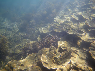
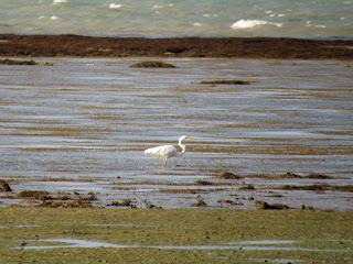
Sargassum dominates the shallows between the coral platforms near the reef edge and the green seagrass beds on the landward margin of the reef
Tall growths of Sargassum are a seasonal feature of inshore coral reefs and often form a single line close to the transition point from shallow to deeper water.  I cannot say whether the massive growths that now blanket inshore reefs during summer used to be present before the first coral bleaching to the extent they are now.  I also cannot say whether Sargassum competes with coral or protects it.  In deeper water with better water flow, Sargassum may shade the coral and help protect it from bleaching.  In other locations, I suspect that Sargassum alters the environment in ways that are not favourable for coral.  Some research is needed.

Sargassum laying down in a shallow lagoon at low tide (April 2016)
Did this coral survive due to its wig of Sargassum?
Turtles were sometimes abundant and one day I counted 30 turtles on a 4 km section of reef front.  When turtles are surprised by an object shaped like a shark, they present their back to the shark’s mouth as a turtle's back is its shield.  To angle themselves in this way, they actually have to swim up into the path of the moving object.  In this case, the object was my competition surf ski and I had the unusual experience of turtles sometimes rising from the bottom and deliberately colliding with the front of my craft.  With one turtle, I paddled backwards a few metres, changed direction and set off again to miss the turtle by a few metres only to have the turtle swim into my craft a second time.  Other large wildlife includes dugong, which are almost impossible to sneak up on and you only know they are close when you see metre wide patches of smooth water forming on the surface that indicate a dugong has swum below.  Large predatory fish such as Australian salmon and sharks swim through the shallow waters and stingrays of many species were usually present in large numbers.  I actually stopped swimming in the shallower sandy channels due to the numbers of stingrays in them and this was long before the Irwin tragedy.

After Cyclone Yasi destroy feeding grounds, many exhausted Green Turtles would beach when the tide retreated (July 2012)
By 2012 most of the reef appeared to have recovered from the 1998 bleaching.  The only element that I have not seen again is the massive coral surface and that is possibly due to navigation issues. Some off-shore reefs that were stunning were laid waste by the 1998 bleaching to the point of being unrecognisable so to see that a reef had recovered was really encouraging.

Well before the event, the 2016 coral bleaching was predicted.  Satellites had identified a vast pool of hot water in the eastern pacific ocean and from past experience, it was known that this pool of water would stream across the pacific to affect the Great Barrier Reef.  The 2015-6 wet season was poor and the skies often crystal clear.  On kayaking my wet hands would be cooled by the breeze but when they dipped into the water, the water was as hot as bath and beyond anything I had experienced.  I heard from others that Yule Reef had gone white so I missed the onset of the event and perhaps have only captured the tail end.

On walking out onto the reef flat, the most obvious change were large patches of white coral.  White coral is dying coral which will either die or if conditions suddenly change for the better, recover.

One of the first corals I saw was completely bleached with more exposed parts already dead
In April 2016, Yule Reef was dominated by patches of stark white in a brown Sargassum matrix
The stark white corals are eye-catching however a second view shows than some corals were not bleached
The area shown above was in or near a shallow lagoon behind the coral platforms of the main reef.  Just to the north is a strip of fringing reef where I discovered that fewer people walk and the coral was in great condition (seen on left of aerial photo).  The entire reef flat was covered with a gray turf of living coral.

Living coral grew like a lawn up to the upper limit of growth (July 2012)
Pre-bleaching coral cover, Yule Reef
A close up of the coral lawn showing two species of branching coral
On revisiting the reef in April 2016, at first sight the reef looked the same. However most of the larger tracts of coral on the reef flat are completely dead.  Some smaller patches of coral in this area still struggling to survive.

The coral is still standing but is dead
A close-up view shows brown slime rather than star shaped coral polyps
Corals in areas with better water flow survived at a least in part
Massive corals (species that grow like boulders) are also present in lower densities and some appear to be fine but others have taken on strange colours.  For massive corals, it seems preferable to be exposed to air, rather than be in the hot waters of the reef shallows.  In the shallows, may corals are not pure white but a florescent light green or yellow.  There were no simple patterns to the bleaching and unaffected corals were scattered through devastated areas.

Stressed massive corals were an abnormal pink colour
Same species of coral bleached to a florescent light green shade
It is clear that huge damage has been done to Yule Reef with coral mortality above 50%.  Inshore reefs regularly take a beating from cyclones and floods so have great powers of recovery, however if the frequency of events increases, there will not be enough time to recover.  There may also be a breakdown of essential processes such as the processes that provide clean hard surfaces for coral larvae to settle on.  To some extent, the process that create good conditions for coral are provided by the coral reef itself.  So Yule Reef survives for now, but it is a diminished place and is on the edge of survival.